")
Another New Auction
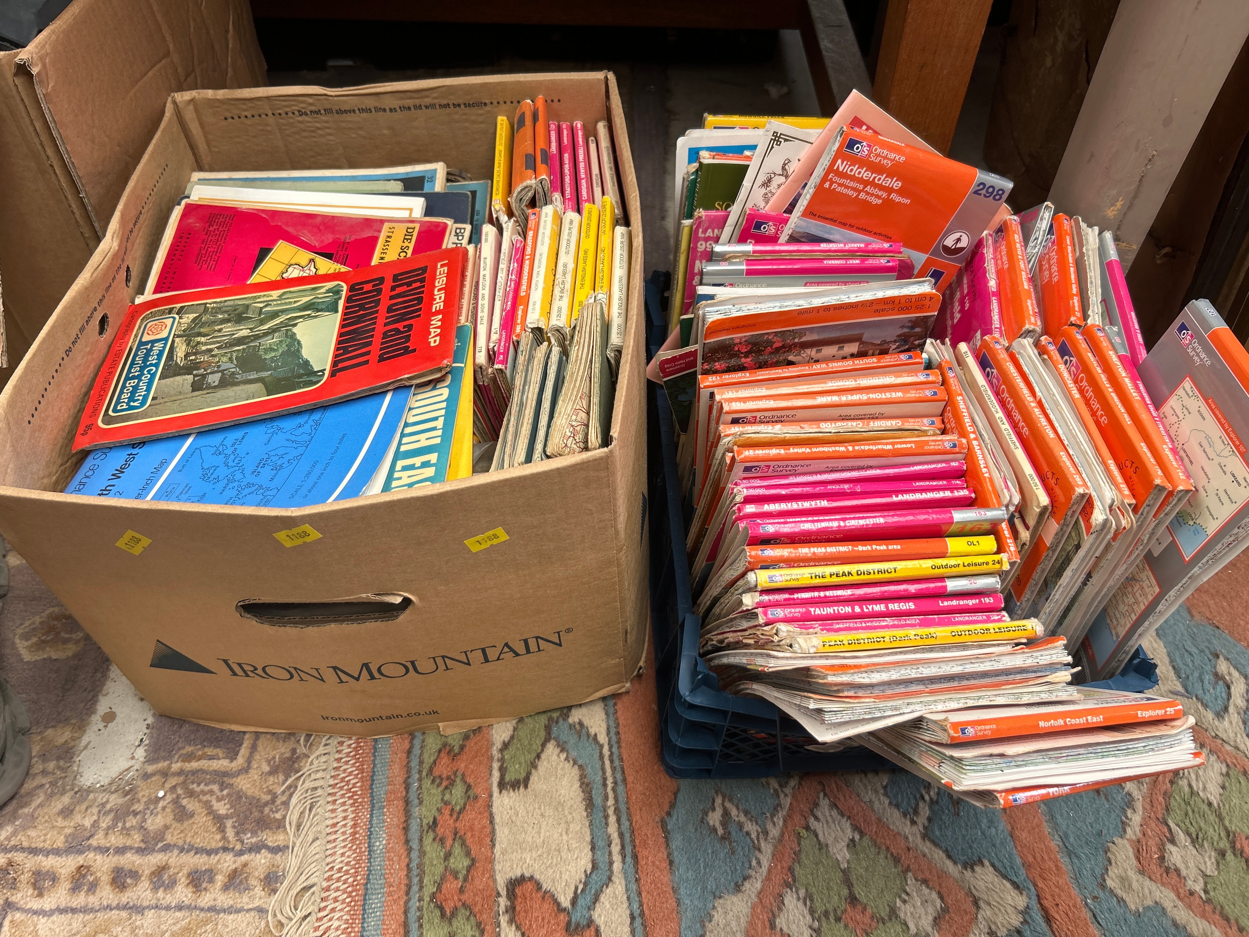
A substantial collection of primarily paper-based geographical materials, consisting of numerous maps and regional guidebooks. The collection is contained within a brown cardboard “IRON MOUNTAIN” box and a blue plastic crate. The bulk of the collection comprises Ordnance Survey maps, including “Landranger” and “Explorer” series, covering a wide range of UK locations such as Nidderdale, The Peak District, Yorkshire Dales, Stratford-upon-Avon, Cardiff, Taunton & Lyme Regis, Norfolk Coast East, Anglesey, Aberystwyth, Cheltenham & Cirencester, and others, often indicating a 1:50,000 scale. Also visible are a “West Country Tourist Board” guide and a German language map titled “DIE SC STRASSEN” (The Streets). The materials appear to span from the late 20th to early 21st century.
Share this lot: