")
Another New Auction
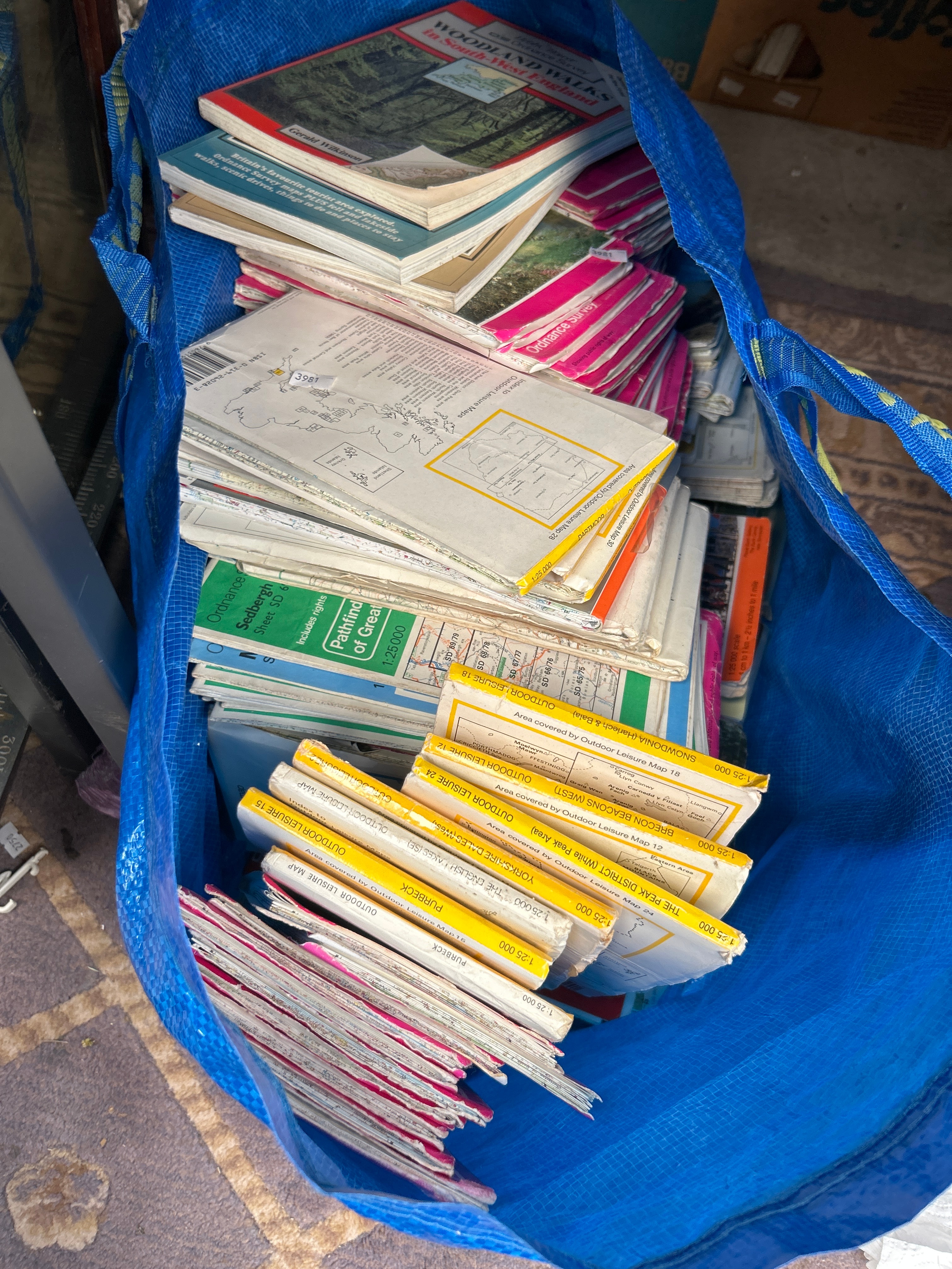
A collection of approximately 30-50 paper-based maps and guidebooks, primarily comprising British Ordnance Survey “Outdoor Leisure Maps” at a 1:25,000 scale. Visible titles include “Ordnance Survey,” “Outdoor Leisure Map” with various numbers (e.g., 12, 15, 18, 24, 28, 30), and specific regional names such as “DARTMOOR,” “THE PEAK DISTRICT (White Peak Area),” “YORKSHIRE DALES (WEST),” “PURBECK,” “BRECON BEACONS (WEST),” and “SNOWDONIA.” Other guidebooks include titles such as “WOODLAND WALKS in South-West England” and “Pathfinder Great,” focusing on walks and tourist areas. The collection dates to a contemporary period, late 20th to early 21st century, with one visible ISBN 0-319-26804-X. The collection is presented within a blue woven plastic IKEA FRAKTA Large Blue 71L Plastic Reusable Bag.
Share this lot: