")
Another Great Auction 12th March 2026
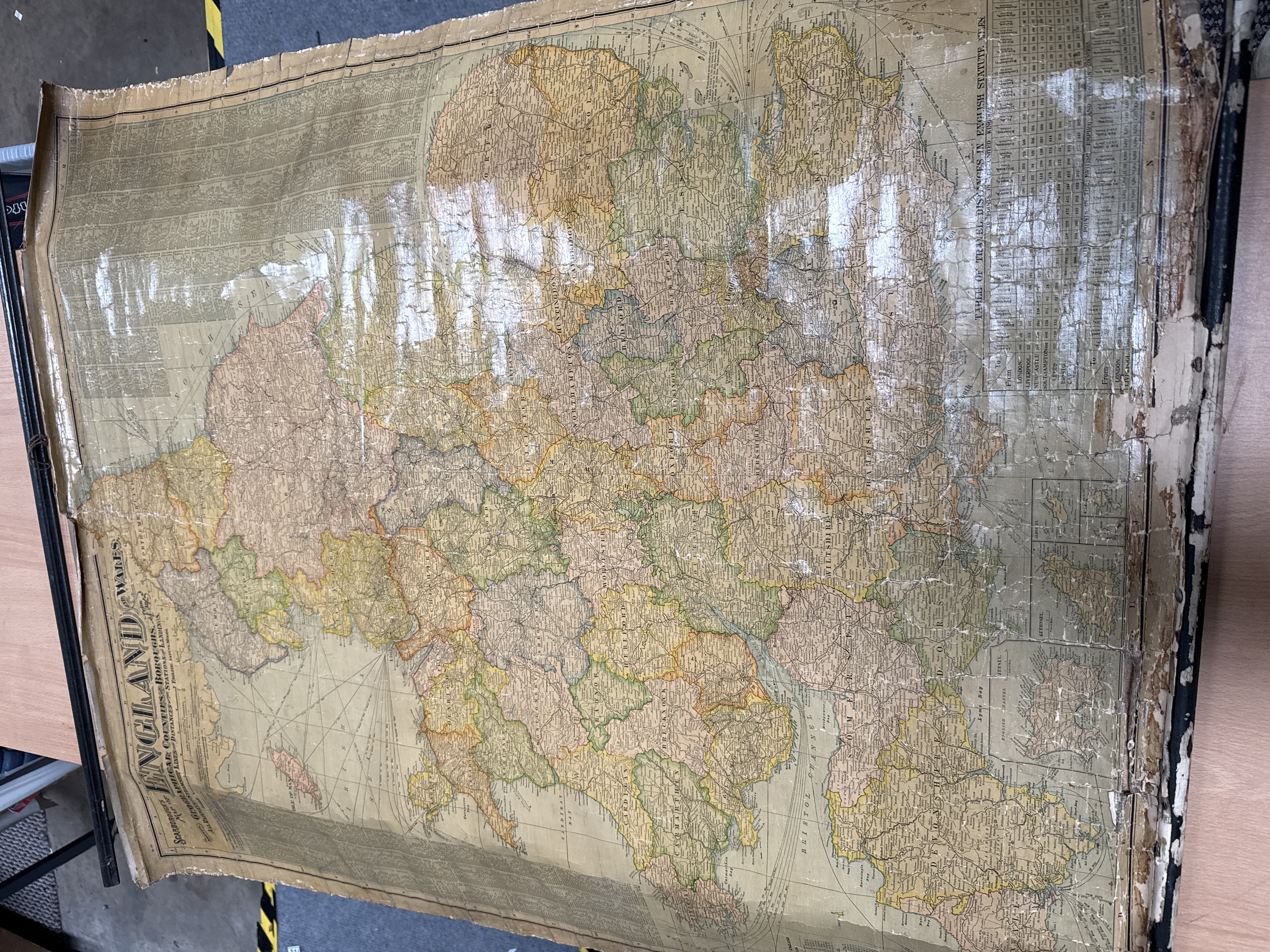
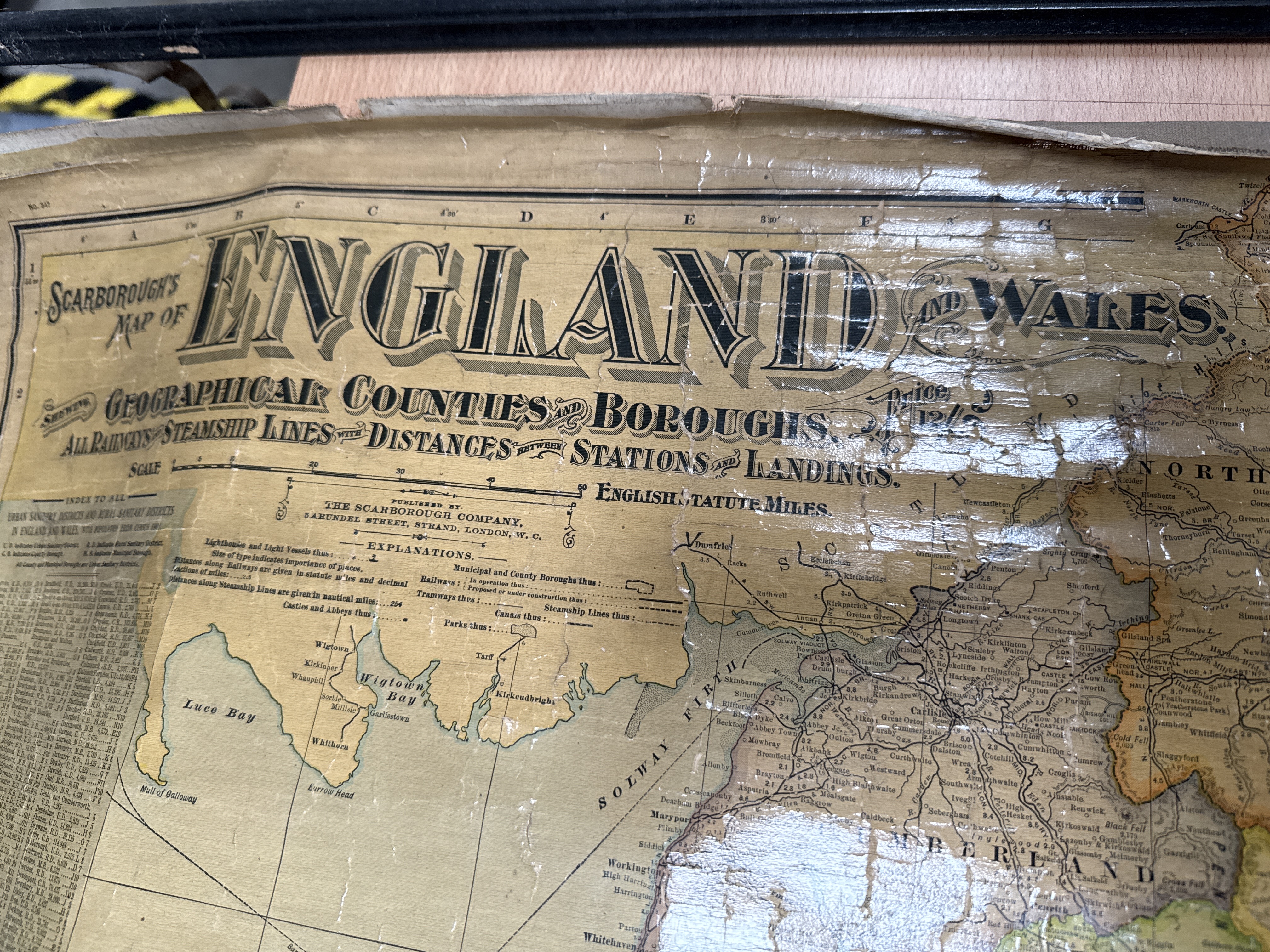
A large-format antique wall map titled Scarborough’s Map of England and Wales, published by The Scarborough Company, 5 Arundel Street, Strand, London. The map is printed on paper, mounted on a wooden roller, and features a varnished finish. It depicts geographical counties and boroughs with colour-coded divisions. The cartography specifically highlights railways and steamship lines, including distances between stations and landings. The map includes an extensive legend, a table of travel distances in English statute miles, and an index to urban and rural sanitary districts.
33 x 46 inches
Share this lot: